IPS CeresAI Precision Agriculture Platforms

We deliver institutional-grade agricultural AI modules that ingest multi-spectral imagery and IoT logs to maximize crop yield, control operational risks, and optimize water and soil inputs.

AI Crop Monitoring Platform

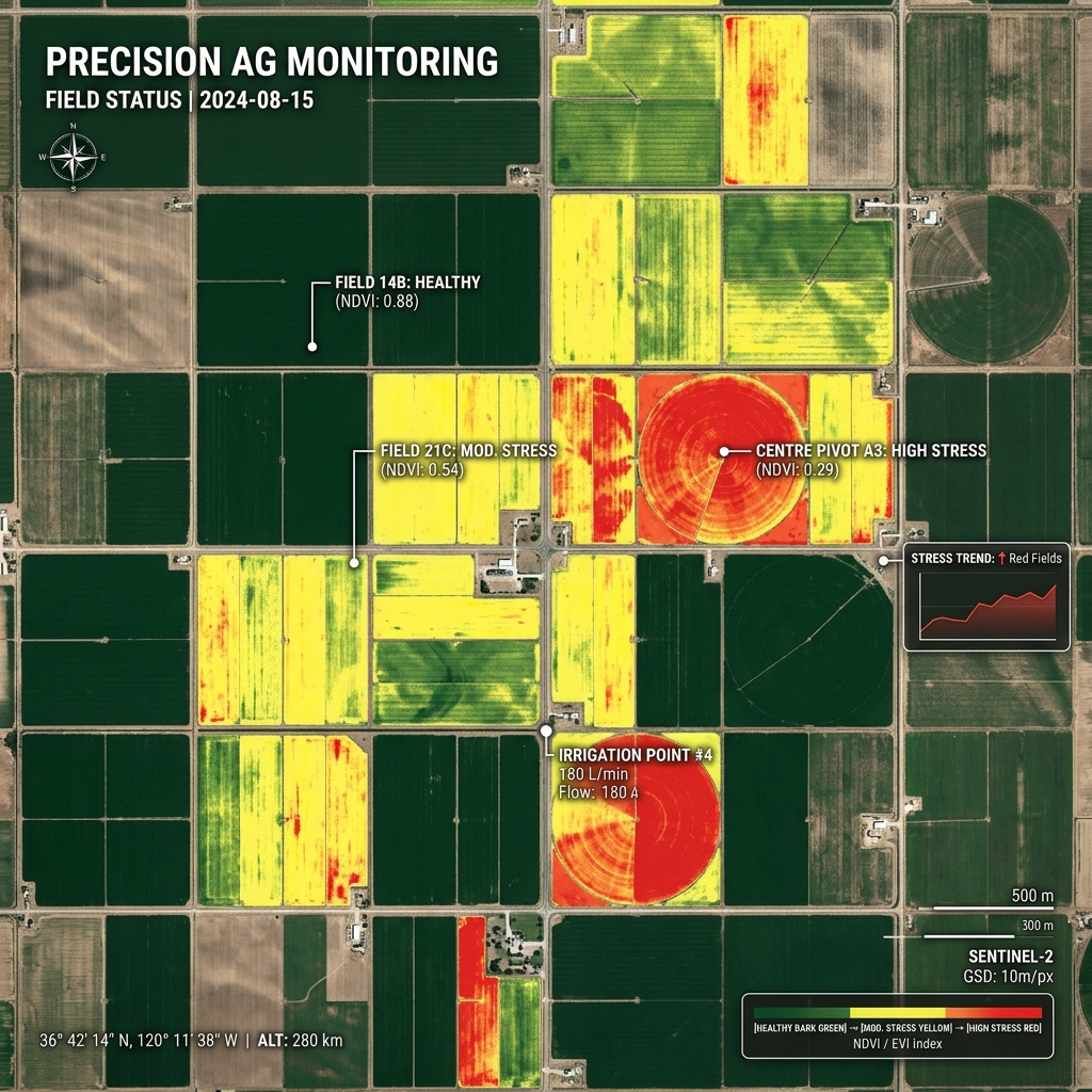
Continuous multispectral remote sensing engine built to monitor growth performance, crop health, and stress anomalies down to the plant level.

  • Automated plant population and spacing checks.
  • Near-infrared NDVI mapping and stress reports.
  • Automatic detection of crop stress hotspots.
Request Platform Demo
Crop Monitor satellite stress analysis map

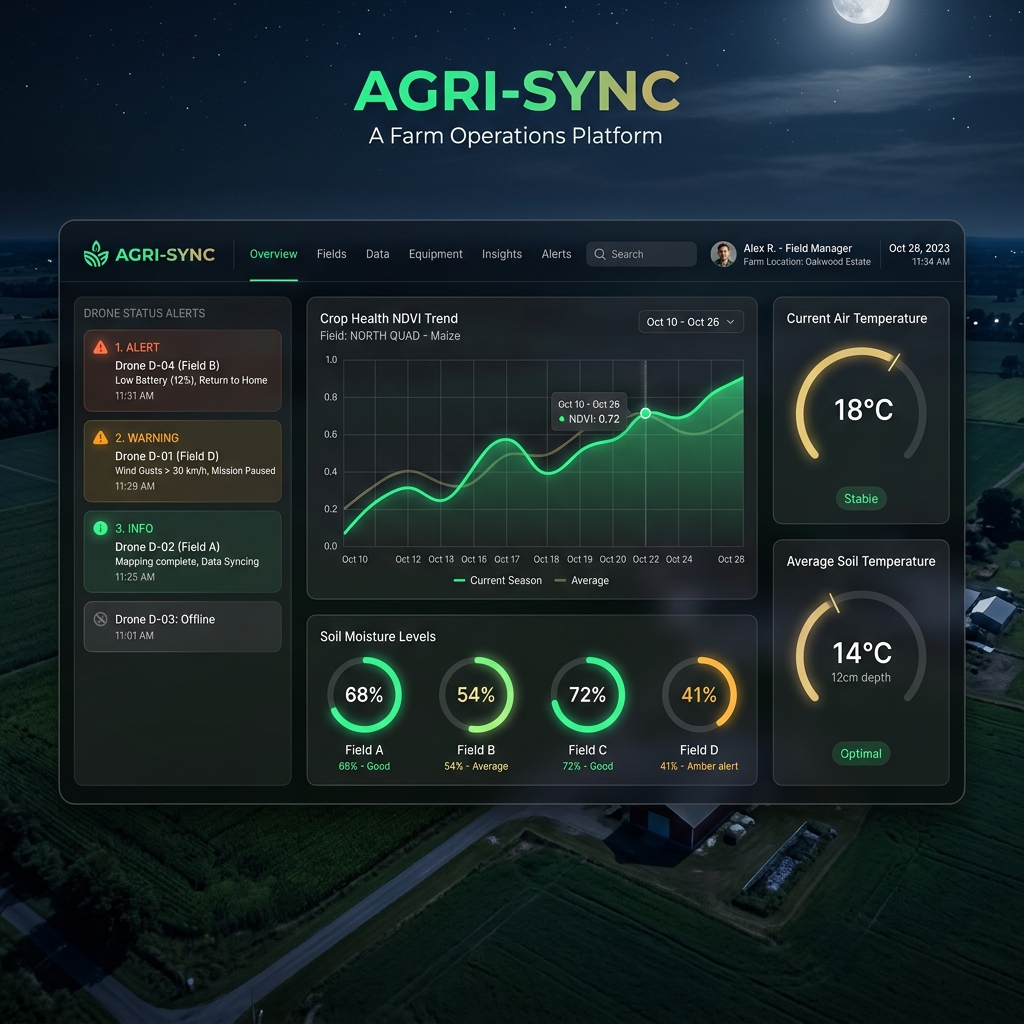
Smart Farm Dashboard

The operational hub for modern farm management. Combines physical parameters, equipment tracking, and analytics models in one screen.

  • Real-time soil moisture and microclimate charts.
  • Dynamic telemetry alerts for field workers.
  • API plugins for John Deere Operations Center.
Open Smart Dashboard
SaaS dashboard screenshot visual

AI Agriculture Assistant (AgriGPT)

Large Language Model explicitly trained on agricultural guides, disease indexes, and research literature. Serves as your on-field agronomist advisor.

  • Natural language chat queries in 12 regional languages.
  • Step-by-step treatment prescriptions.
  • Offline support capabilities for field-side access.
Talk to AgriGPT
AgriGPT Expert Advisor | Active Node

User: My potato leaves have circular dark spots with concentric rings. What is this?

AgriGPT: This diagnosis suggests Early Blight (Alternaria solani).

Recommended steps:
1. Prune lower infected foliage to suppress spore bounce-up.
2. Avoid overhead sprinklers; shift irrigation to drip lines.
3. If threshold is exceeded, apply copper-based organic fungicides.

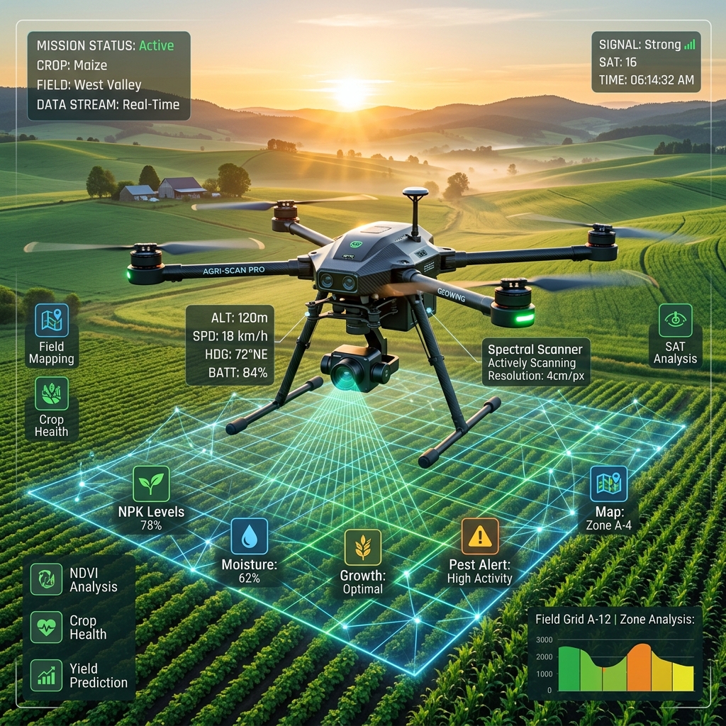
Drone Intelligence Platform

Auto-generate autonomous drone flight lines, process orthomosaic models, and segment field anomalies using edge-computer vision.

  • Automated 3D field contour flight planning.
  • Cloud-based orthomosaic image stitching.
  • Immediate plant count and weed distribution mapping.
Deploy Drone Engine
Agriculture drone flyover analysis

Agricultural Analytics Platform

Convert historic yields, fertilizer logs, and geospatial weather maps into highly detailed resource prescription guidelines.

  • Variable Rate Application (VRA) maps for nitrogen spread.
  • Operational efficiency tracking for farm fleets.
  • Historic yield correlation charts.
Open Analytics Engine
Variable rate prescription crop stress maps

Variable Rate Prescriptions

Optimize fertilizer deployment according to localized ground requirements rather than uniform broadcasting.

Zone A
Zone B
Zone C
Zone D
Variable Nitrogen Application rate requirements (kg/hectare)

Weather Intelligence System

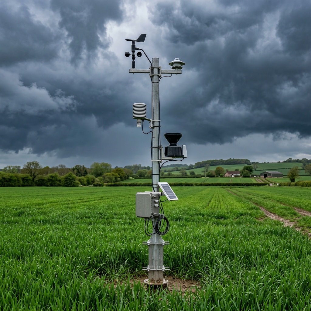
Hyper-local weather engines driven by specialized atmospheric models. Delivers field-specific frost warnings and harvest window estimations.

  • Specialized 500-meter grid resolution forecasts.
  • Automated SMS/WhatsApp warnings for freeze and wind gusts.
  • Cumulative Heat Unit tracking metrics.
Check Weather Station
Microclimate meteorological sensor station
Local Weather Station High Wind Alert
32°C
RealFeel 35°C
Wind: 28 km/h NW
Moisture Index: 42%
IPS CeresAI Recommendation: Delay drone aerial spray operations until wind speed falls below 15 km/h (Expected Tuesday, 06:00 AM).

Try IPS CeresAI Telemetry Terminal

Simulate critical agricultural conditions to see how the IPS CeresAI engine automatically interprets telemetry signals and generates variable warnings.

Select Scenario:
> IPS CeresAI Systems online. Awaiting telemetry input parameters...